Land Clearing & Brush Removal in Pollock Pines, CA
Wildfire Prevention & Forest Management at 4,000 Feet Elevation
Protecting Pollock Pines Mountain Properties
Brushtech Land Management serves Pollock Pines, a heavily forested mountain community at nearly 4,000 feet elevation on Highway 50. In the wake of the devastating King Fire (2014) and Caldor Fire (2021), this community knows the critical importance of professional wildfire prevention and forest management.
Designated as a "Very High Fire Hazard Severity Zone," Pollock Pines properties require specialized expertise in defensible space creation, fire break installation, and fuel reduction. Alpine-capable equipment and mountain terrain experience make Brushtech the trusted choice for protecting your mountain home.
Land Management Services in Pollock Pines
Specialized wildfire prevention and forest management for heavily timbered mountain properties
Fire Breaks & Defensible Space
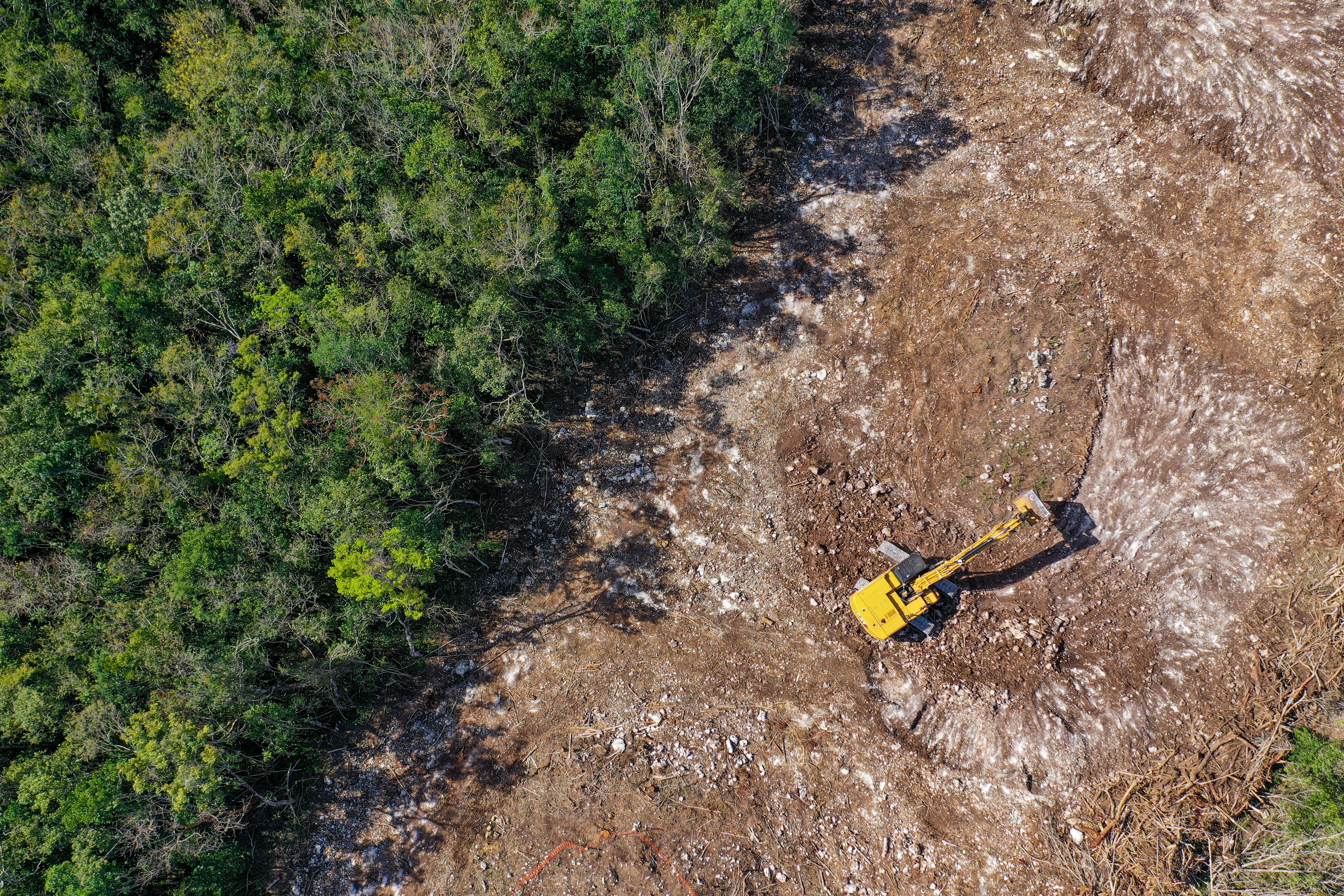
Critical wildfire protection for Pollock Pines' extreme fire risk. Brushtech creates CAL FIRE-compliant 100-foot defensible space zones and strategic fire breaks designed for dense conifer forests and steep mountain terrain.
- CAL FIRE 100-foot defensible space
- Strategic fire break installation
- Heavy fuel load reduction
- Forest thinning and spacing
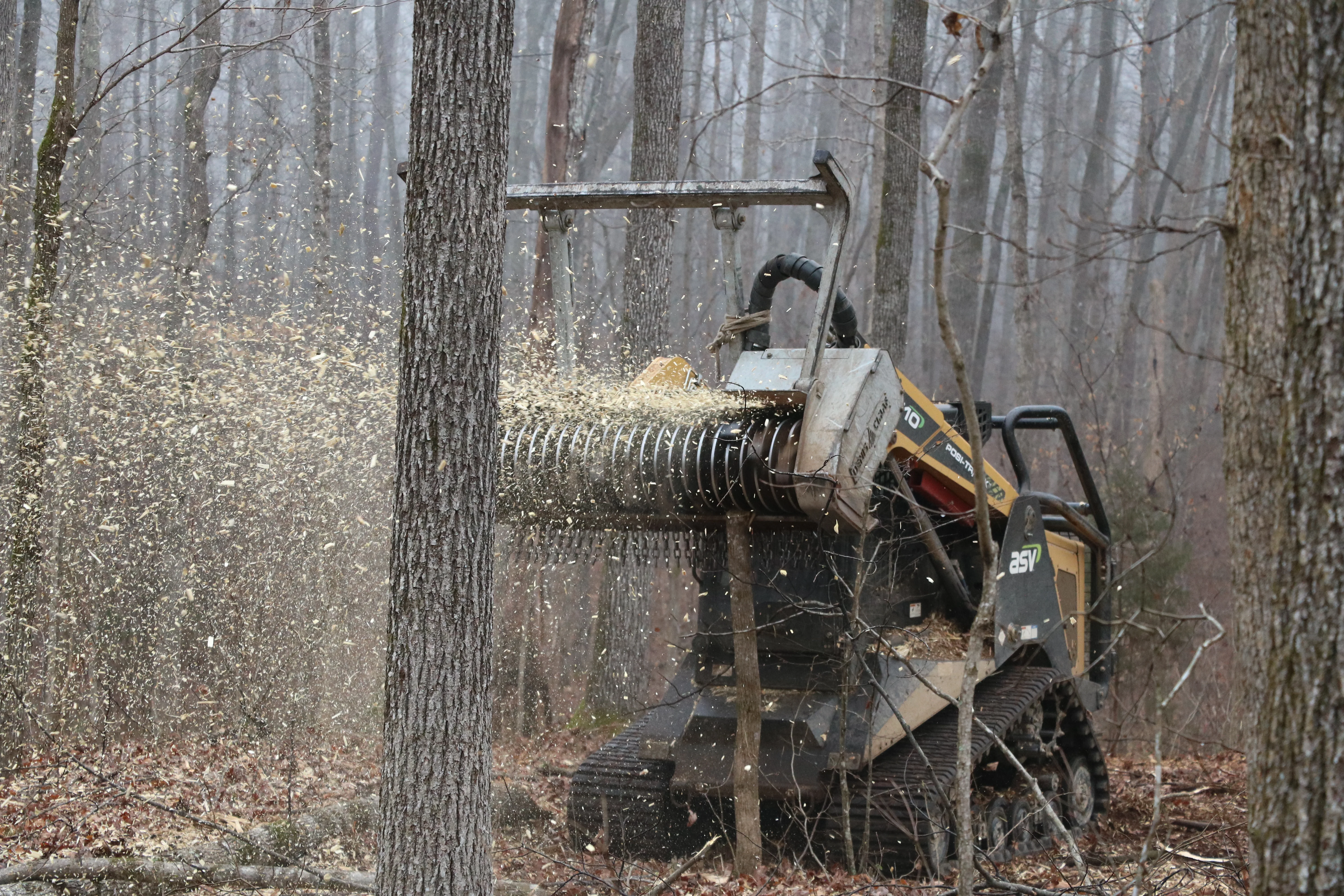
Forest Thinning & Land Clearing
Professional thinning for Pollock Pines' dense conifer forests. Fire risk is reduced by decreasing forest density while maintaining the natural beauty of your mountain property at 4,000 feet elevation.
- Conifer forest density reduction
- Selective clearing (preserve key trees)
- Complete lot clearing for construction
- Stump removal and grinding
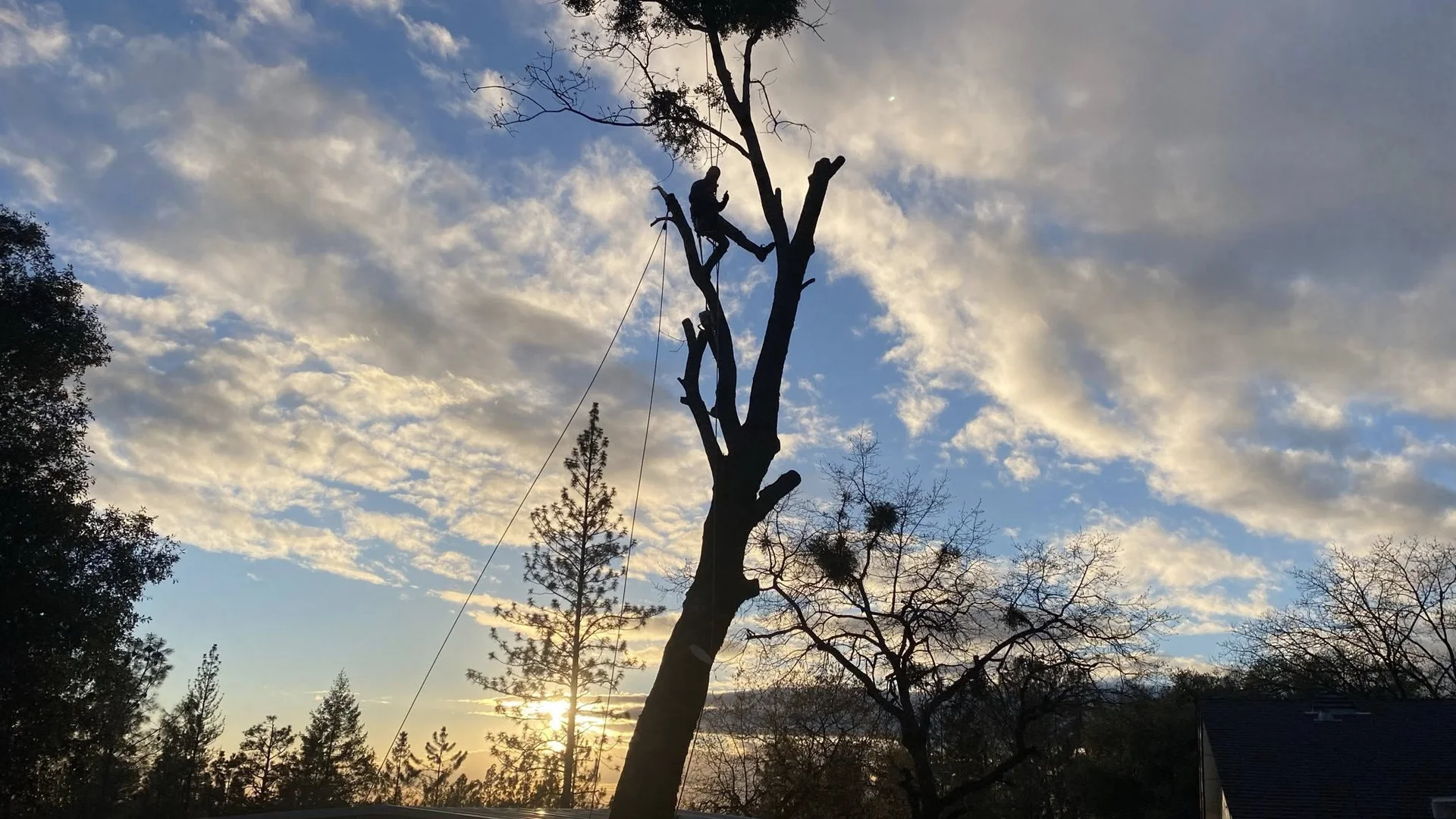
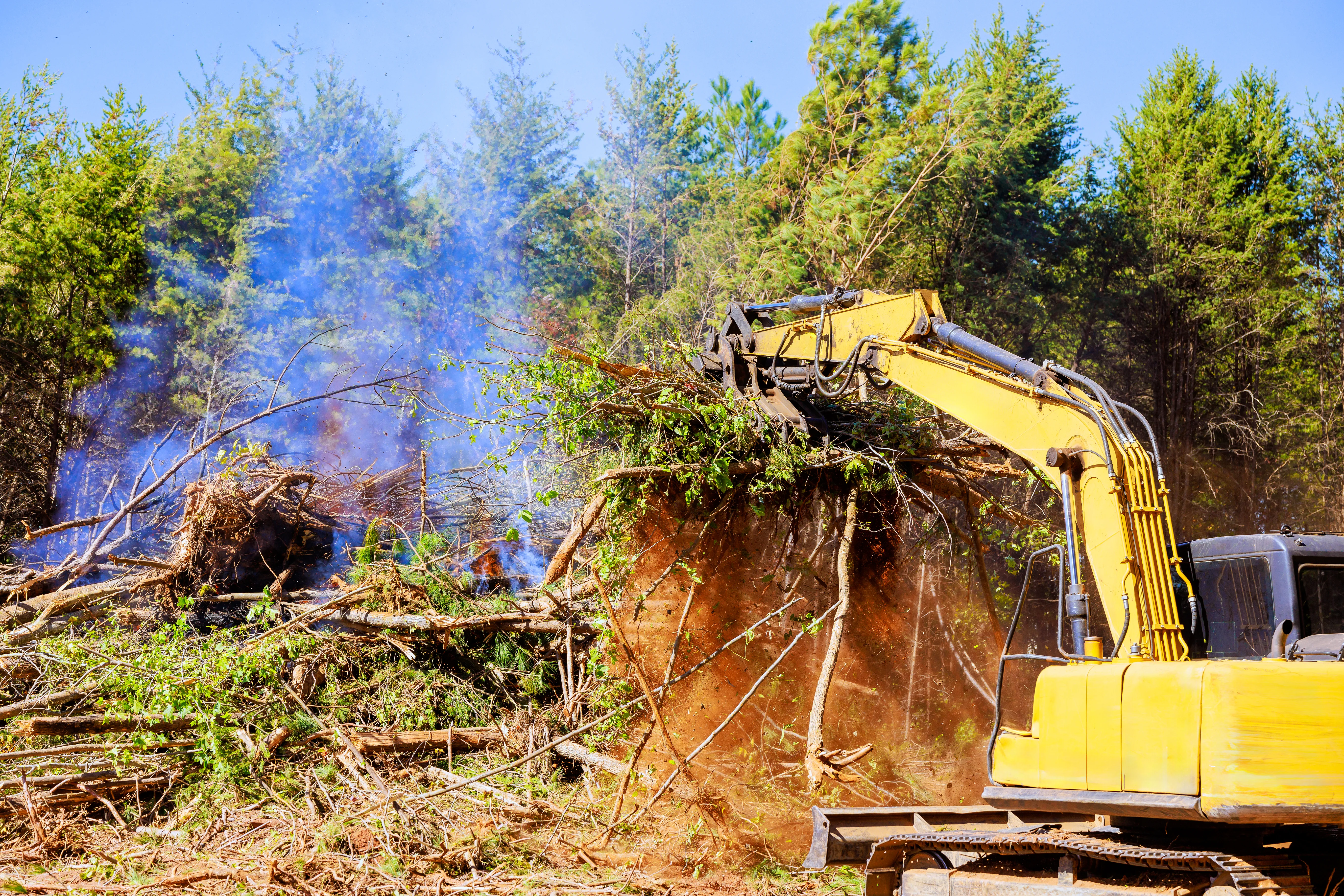
Hazard Tree Removal
Expert tree removal for pine, fir, and mixed conifer forests. Focused on hazardous and dead tree removal for fire safety, the crew works safely on steep mountain properties with specialized equipment.
- Hazardous tree removal
- Dead and dying tree removal
- Deadwood and ladder fuel removal
- Storm damage cleanup
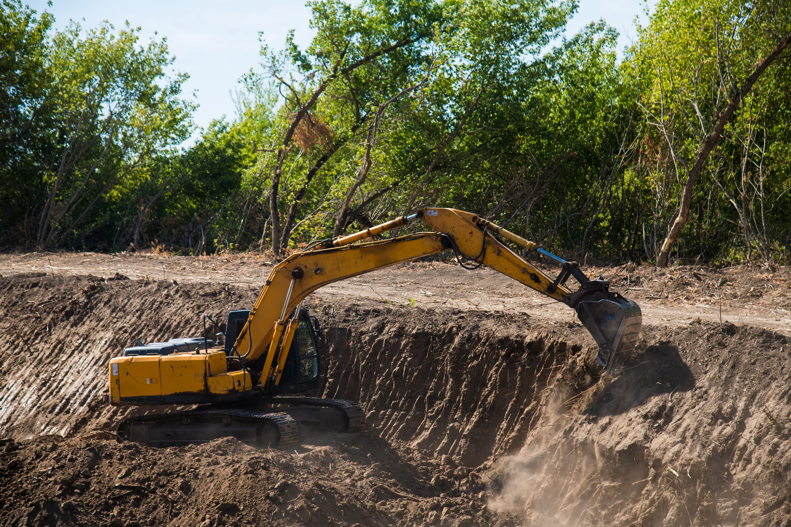
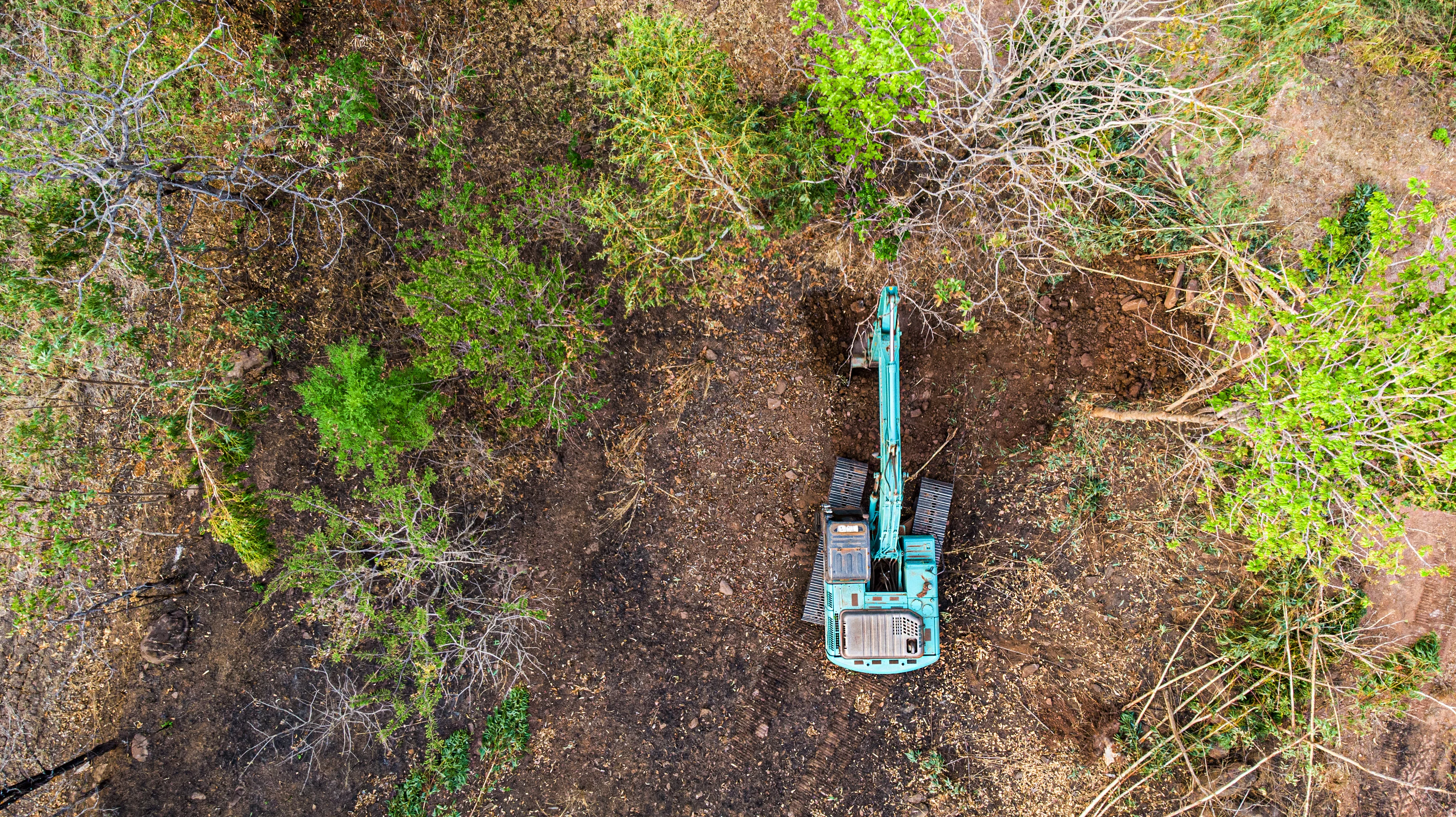
Excavation & Haul Off
Mountain-ready excavation for Pollock Pines properties. Foundation work, trenching, and site preparation with equipment designed for high elevation and steep terrain conditions.
- Foundation excavation
- Utility trenching
- Mountain slope grading
- Site preparation at elevation

Mountain Road Work
Durable road construction for Pollock Pines' mountain environment. Professional gravel road installation and maintenance designed to withstand winter snow and seasonal access challenges.
- Mountain gravel road construction
- Winter damage repair
- Steep driveway installation
- Drainage for snow melt management
Vegetation Management
Year-round forest and vegetation management for extreme fire risk areas. Customized programs maintain your defensible space and reduce fuel loads in Pollock Pines' heavily timbered landscape.
- Seasonal fuel reduction programs
- Brush and understory clearing
- Fire break maintenance
- Pre-fire season preparation
Pollock Pines Neighborhoods
Serving all neighborhoods and communities throughout Pollock Pines and surrounding mountain areas
Pollock Pines Town Center
The commercial core along Highway 50 includes businesses, services, and surrounding residential neighborhoods. Critical fire break installation is available for commercial properties and homes in this densely developed mountain area, ensuring CAL FIRE compliance while maintaining accessibility for year-round residents.
Sly Park & Jenkinson Lake Area
Properties near Sly Park Recreation Area and Jenkinson Lake feature dense conifer forests and steep mountain terrain. Brushtech specializes in creating defensible space for lakeside homes and vacation properties while navigating challenging access routes and heavy timber typical of this popular recreational area.
Pino Grande & Mountain Estates
The upscale residential areas including Pino Grande and similar mountain estates feature large parcels with heavy forest coverage at 4,000+ feet. Specialized equipment handles steep slopes and dense timber, creating comprehensive fire breaks and maintaining defensible space for high-value mountain homes.
North & South Pollock Pines
Residential neighborhoods spreading north and south from Highway 50 include both older established homes and newer mountain construction. Fire break maintenance, forest thinning, and fuel reduction programs are tailored to each property's unique forest density and slope conditions at this critical elevation.
Pacific House & Camino Areas
Properties extending toward Pacific House and Camino feature mixed forest and varying terrain. Brushtech handles the transition zones between communities, providing vegetation management for properties along the Highway 50 corridor and rural mountain roads with consistent wildfire protection services.
Upper Mountain Properties
The highest elevation areas approaching 4,500 feet include the most heavily forested properties with significant snowfall. Alpine-capable equipment creates fire breaks and manages vegetation in these extreme conditions, working during accessible months to maintain year-round protection for remote mountain homes.
Driving Directions to Pollock Pines
From Sacramento
Via Highway 50 East (55 minutes)
- Take US-50 East toward South Lake Tahoe
- Continue approximately 52 miles through Folsom, El Dorado Hills, and Placerville
- Continue on Highway 50 past Camino and Fresh Pond
- Arrive at Pollock Pines town center
Distance: ~52 miles | Time: 55-65 minutes
From Placerville
Via Highway 50 East (18 minutes)
- Take US-50 East from downtown Placerville
- Continue approximately 15 miles climbing toward the Sierra
- Pass through Camino and Fresh Pond
- Enter Pollock Pines at 4,000 feet elevation
Distance: ~15 miles | Time: 18-22 minutes
From South Lake Tahoe
Via Highway 50 West (42 minutes)
- Take US-50 West from South Lake Tahoe
- Descend Echo Summit and Twin Bridges
- Continue through Kyburz and Strawberry
- Arrive at Pollock Pines (descending from 6,200+ feet)
Distance: ~38 miles | Time: 42-50 minutes
From Cameron Park/El Dorado Hills
Via Highway 50 East (38 minutes)
- Take US-50 East from Cameron Park
- Continue through Shingle Springs and Placerville
- Climb from 1,000 feet to 4,000 feet elevation
- Enter Pollock Pines mountain community
Distance: ~35 miles | Time: 38-48 minutes
Local Landmarks Near Pollock Pines
Pollock Pines is located on Highway 50 at 4,000 feet elevation. Look for these well-known landmarks:
- Pollock Pines Fire Station - Highway 50 town center
- Sly Park Recreation Area - Sly Park Road (Jenkinson Lake)
- Pollock Pines Market - 5791 Pony Express Trail (Highway 50)
- Sand Ridge Elementary School - 3590 Sanders Drive
- Fresh Pond Road Junction - Highway 50 west of town
Weather & Seasonal Challenges in Pollock Pines
Understanding mountain climate patterns at 4,000 feet for effective year-round land management
Summer Fire Season (June - October)
Temperature Range: 78-88°F daytime, 48-58°F nights
Conditions: Warm, dry mountain climate with low humidity (15-25%). Extended dry periods create extreme wildfire conditions.
Challenges & Solutions:
- Extreme fire danger: Pollock Pines' Very High Fire Hazard Severity Zone designation reflects catastrophic risk proven by King and Caldor fires. Complete all defensible space work by late May before peak danger begins.
- Dense conifer fuel loads: Heavy pine and fir forests at 4,000 feet create massive fuel concentrations. Aggressive fuel reduction and forest thinning are non-negotiable for property protection.
- Post-fire recovery areas: Properties in or near King Fire and Caldor Fire burn zones require specialized clearing. Brushtech navigates burned areas safely while creating protection for rebuilt homes.
- Mountain wind events: Afternoon upslope winds and evening downslope patterns rapidly spread fires. Strategic fire break placement accounts for Pollock Pines' wind corridors and ridge topography.
Winter Season (December - March)
Temperature Range: 38-48°F daytime, 24-32°F nights
Conditions: Significant snow accumulation with 50-80 inches annual snowfall. Frequent winter storms from atmospheric rivers.
Challenges & Solutions:
- Heavy snow loads: Winter storms dump 1-3 feet of snow at a time at 4,000 feet elevation. Projects are coordinated during dry periods between storms, with tracked equipment capable of working in snow.
- Limited access periods: Highway 50 occasionally closes during severe storms. Major clearing projects are planned for late spring through fall when mountain access is reliable.
- Snow damage to trees: Heavy wet snow breaks branches and tops trees, creating hazards. Winter storm damage cleanup and hazardous tree removal are available when weather allows.
- Equipment limitations: Frozen ground and snow coverage limit excavation work. Tree removal and planning take priority during winter months, with earthwork scheduled for spring thaw.
Spring Season (April - June)
Temperature Range: 58-72°F daytime, 38-48°F nights
Conditions: Transition season with melting snow, muddy conditions, and increasing fire preparation urgency.
Challenges & Solutions:
- Critical fire prep window: Late spring is the last opportunity for defensible space work before summer fire season. Brushtech is at maximum capacity May-June as property owners prepare for proven wildfire risk.
- Snowmelt access challenges: Melting snow creates muddy roads and saturated soils. Projects are timed carefully, using tracked equipment when necessary to reach remote properties during transition conditions.
- Rapid vegetation growth: Mountain understory explodes after snowmelt, growing several inches per week. Immediate clearing prevents vegetation from drying into fire fuel by July.
- Optimal clearing conditions: Late May through June offers ideal weather–dry enough for equipment access, early enough to complete work before fire season begins in earnest.
Fall Season (September - November)
Temperature Range: 65-78°F daytime, 42-52°F nights
Conditions: Extended fire season through October, cooling temperatures, and early season snowfall possible by November.
Challenges & Solutions:
- Extended fire season: Wildfires continue into October at 4,000 feet elevation. Maintain vigilant defensible space upkeep through fall–Caldor Fire burned into September and October.
- Pre-winter preparation: Excellent time for clearing projects before snow arrives. Major work is scheduled in September-October while access is good and before winter weather limits operations.
- Early snow events: Surprise early-season storms can dump significant snow by late October. Forecasts are monitored carefully and schedules adjusted to complete projects before winter closes the work window.
- Fire break assessment: Fall is ideal for evaluating summer fire break performance and planning winter clearing projects during vegetation dormancy.
Elevation-Specific Considerations
Pollock Pines' elevation of 3,980 feet places it in the high-mountain zone with critical characteristics:
- Very High Fire Hazard Severity Zone: Official CAL FIRE designation reflects extreme risk proven by King Fire (2014) and Caldor Fire (2021). Enhanced defensible space requirements apply to all properties.
- Dense conifer forests: Heavy pine, fir, and cedar forests with manzanita understory create massive fuel loads. Regular professional fuel reduction is essential–not optional–for property survival.
- Significant winter snowfall: 50-80 inches annual snow requires seasonal planning. Major clearing projects must be scheduled during snow-free months (May-November) for reliable access and equipment operation.
Why Choose Brushtech in Pollock Pines
Mountain Terrain Expertise
Specialized experience working at 4,000 feet elevation with equipment designed for steep slopes, dense forests, and challenging mountain conditions. Brushtech understands Pollock Pines' unique terrain.
Fire Zone Specialists
Proven expertise in Very High Fire Hazard Severity Zones. Brushtech knows exactly what's required to protect your property in one of California's most fire-prone mountain communities.
Post-Fire Recovery Experience
Extensive experience helping Pollock Pines property owners recover from the King and Caldor fires. Brushtech understands the emotional and practical challenges of wildfire recovery and prevention.
Year-Round Service
Equipment and expertise to work in Pollock Pines' variable conditions, from 6 inches to 6 feet of annual snowfall. Brushtech is here when you need help, regardless of season.
Frequently Asked Questions - Pollock Pines
How can a Pollock Pines property be protected after the Caldor Fire?
The best protection is creating and maintaining CAL FIRE-compliant defensible space. Brushtech provides comprehensive fire break installation, forest thinning, fuel reduction, and ongoing vegetation management specifically designed for Pollock Pines' dense conifer forests and extreme fire risk.
What are CAL FIRE's defensible space requirements at 4,000 feet elevation?
Pollock Pines properties must maintain 100 feet of defensible space around all structures, with increased requirements in Very High Fire Hazard Severity Zones. This includes tree spacing, ladder fuel removal, and brush clearing. Brushtech ensures full compliance while working with your mountain terrain.
Do you provide forest thinning and fuel reduction in Pollock Pines?
Absolutely. Forest thinning is critical for Pollock Pines' heavily timbered properties. Brushtech selectively thins dense conifer stands, removes ladder fuels, reduces brush, and creates strategic spacing to dramatically reduce fire risk while preserving your forest's beauty.
Can you create fire breaks in heavily forested mountain properties?
Yes. Brushtech specializes in fire break creation for dense mountain forests. Professional equipment handles Pollock Pines' steep slopes and heavy timber, creating effective fire breaks that protect your property while respecting the natural landscape.
How much does wildfire prevention cost in the Pollock Pines area?
Costs vary based on property size, forest density, terrain steepness, and scope of work. Mountain properties at 4,000 feet elevation require specialized equipment and expertise. Contact Brushtech for a free assessment and detailed quote specific to your Pollock Pines property.
Ready to Protect Your Pollock Pines Property?
Get a free quote for professional wildfire prevention and forest management services