Land Clearing & Brush Removal in Foresthill, CA
Expert Mountain Ridge Vegetation Management Between the American River Forks
Protecting Foresthill's Mountain Ridge Properties
Brushtech Land Management serves Foresthill, a historic Gold Rush town uniquely positioned on a broad ridge between the North and Middle Forks of the American River. At 2,169 feet elevation with 51.69 inches of annual precipitation, this Placer County mountain community creates heavy vegetation that becomes significant fire fuel during hot, dry summers.
With complex topography, steep canyon sides, and dense forests fed by high precipitation, Foresthill properties require specialized expertise in fire break creation, vegetation management, and terrain navigation. Brushtech's mountain-ready equipment and ridge location experience protect properties in one of the region's most challenging environments.
Brushtech Services in Foresthill
Specialized mountain ridge services for Foresthill's unique terrain and high-precipitation environment
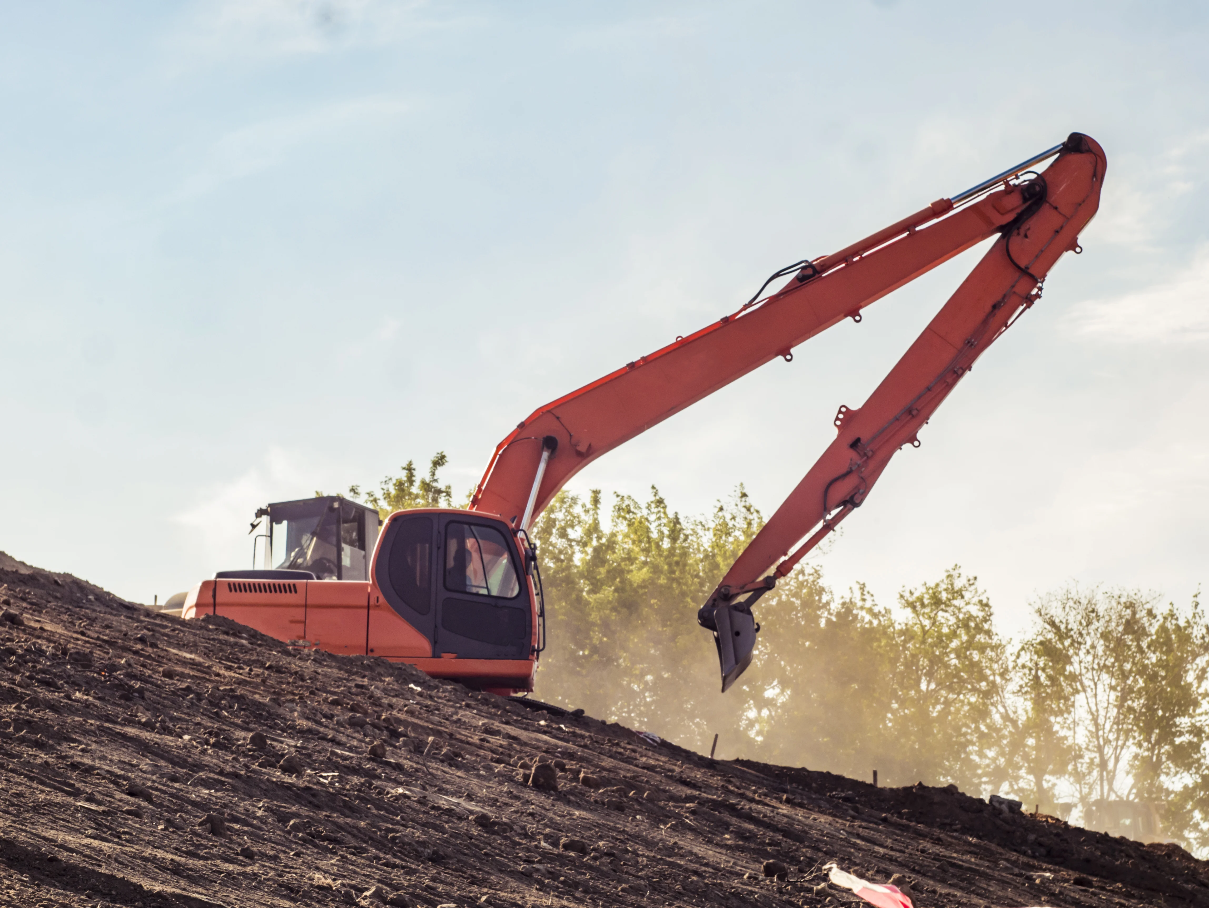
Fire Breaks & Defensible Space
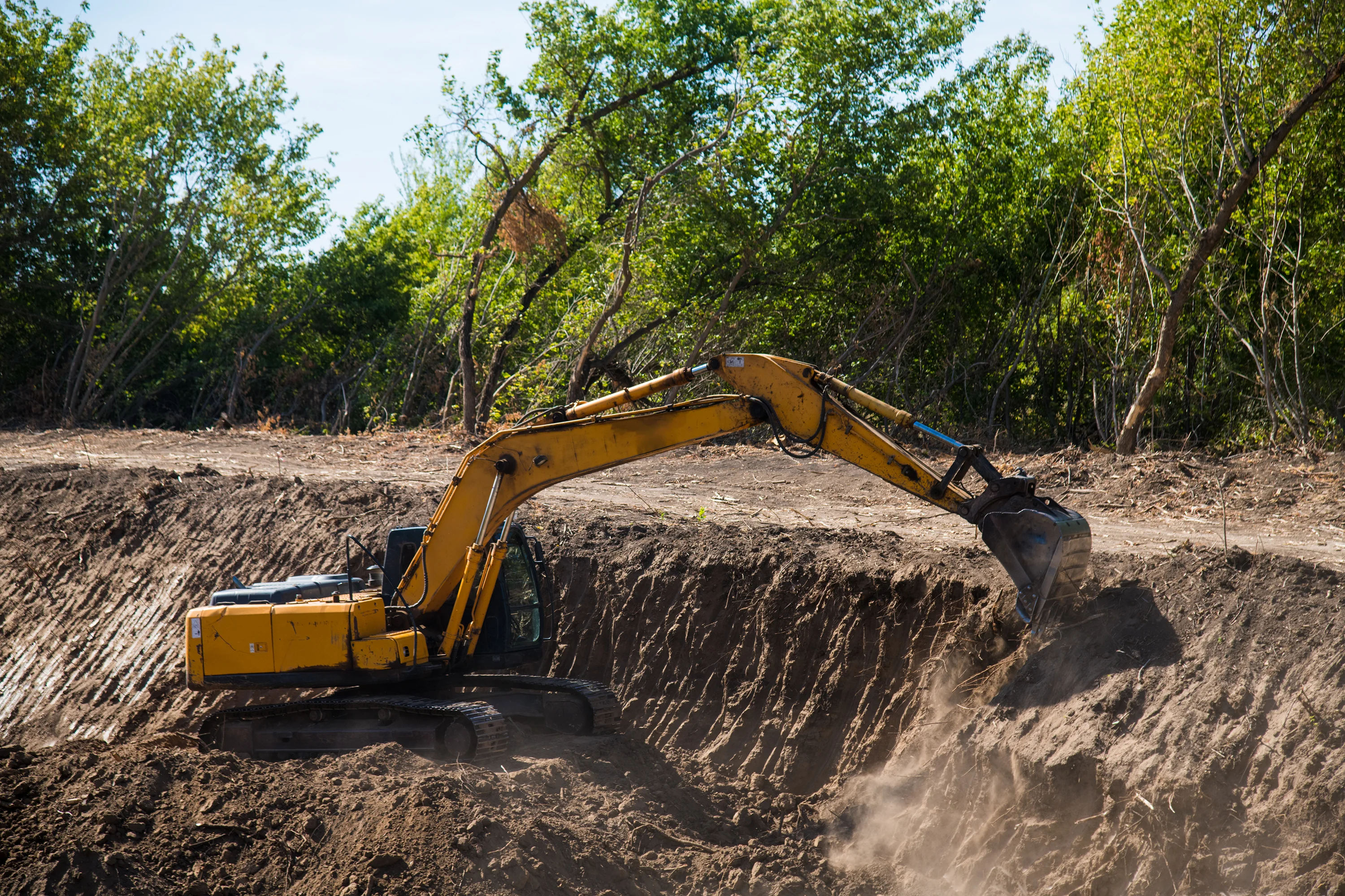
Critical wildfire protection for Foresthill's ridge location between river canyons. Brushtech creates CAL FIRE-compliant defensible space zones and strategic fire breaks designed for heavy vegetation growth and complex topography.
- Ridge-specific fire break installation
- 100-foot defensible space zones
- Heavy fuel load reduction
- Canyon edge protection strategies
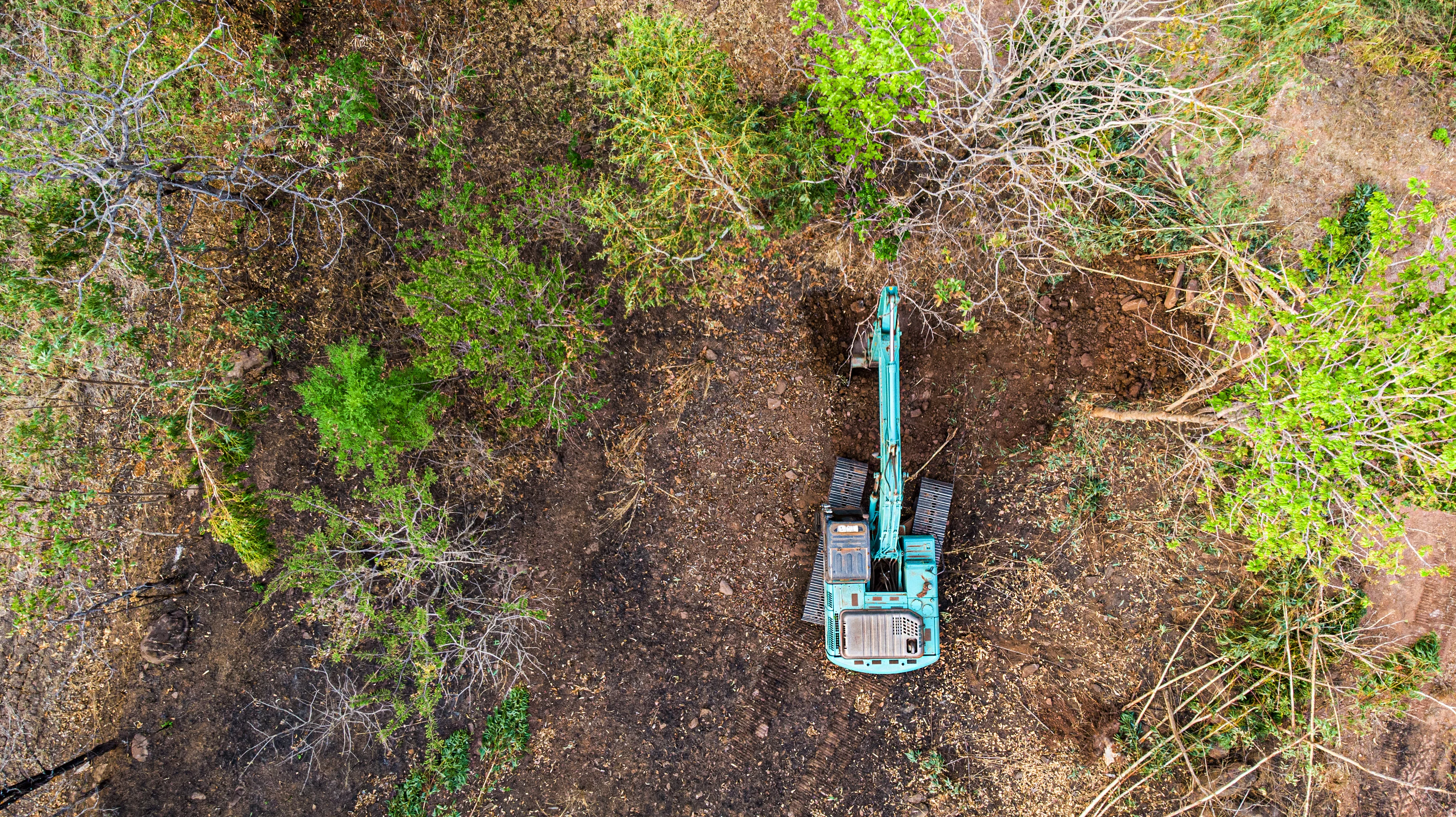
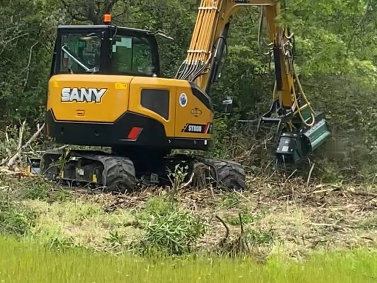
Land Clearing
Professional clearing for Foresthill's dense mountain forests. High precipitation creates abundant growth - vegetation is managed while navigating steep slopes and the unique challenges of ridge-top properties.
- Dense forest clearing
- Ridge property lot preparation
- Selective clearing (preserve key trees)
- Stump removal and grinding
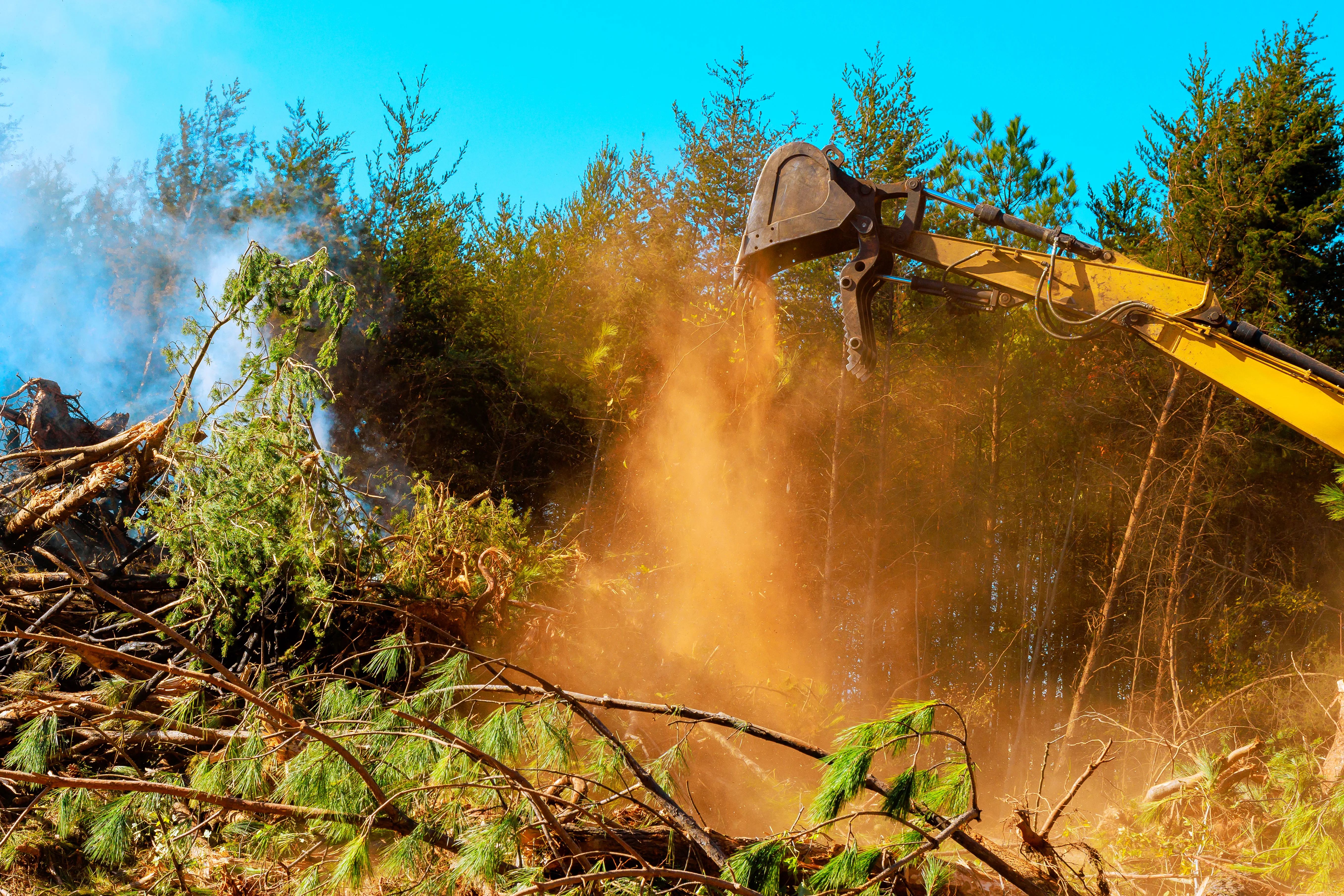
Hazard Tree Removal
Expert tree care for Foresthill's heavy timber. From hazardous tree removal on steep canyon edges to thinning dense stands, the crew works safely in challenging mountain terrain with specialized equipment.
- Hazardous tree removal
- Forest density reduction
- Storm and snow damage cleanup
- Ladder fuel elimination

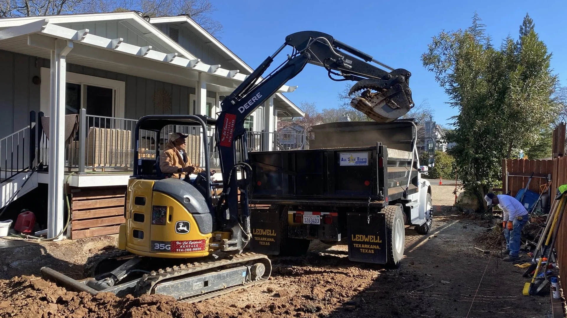
Excavation & Haul Off
Mountain excavation for Foresthill's complex geology: foundation work, trenching, and site preparation on ridge properties with historic mining tunnels and challenging subsurface conditions.
- Ridge property excavation
- Utility trenching
- Slope grading and stabilization
- Complex terrain site work
Mountain Road Work
Durable road construction for Foresthill's steep access routes. Professional gravel road installation and maintenance designed for ridge properties, winter weather, and 25.7 inches of annual snowfall.
- Steep access road construction
- Winter damage repair
- Ridge property driveway installation
- Heavy precipitation drainage systems
Vegetation Management
Year-round vegetation control for Foresthill's high-precipitation environment. Customized programs manage the heavy growth created by 51+ inches of annual rainfall while reducing fire risk.
- High-precipitation vegetation control
- Seasonal fuel reduction programs
- Dense brush and understory clearing
- Fire break maintenance
Foresthill Neighborhoods
Brushtech proudly serves all neighborhoods and communities throughout Foresthill and the surrounding mountain ridge area
Downtown Foresthill & Main Street
The historic town center along Foresthill Road features the famous 100-foot-wide Main Street, designed for fire safety after the 1852 fire. Brushtech provides fire break installation and vegetation management for both commercial properties and surrounding residential areas, maintaining CAL FIRE compliance while preserving this historic mountain community's character.
Foresthill Bridge Area
Properties near the iconic Foresthill Bridge (730 feet high, one of America's tallest bridges) feature stunning canyon views and challenging terrain. Brushtech specializes in creating defensible space on steep slopes near the North Fork American River canyon while navigating dramatic topography and ensuring safety near this world-famous landmark.
Foresthill Divide Properties
Homes along the ridge dividing the North and Middle Forks of the American River face unique fire risk from both canyon sides. Brushtech's specialized equipment creates strategic fire breaks accounting for ridge topography, canyon winds, and the heavy vegetation growth fueled by Foresthill's 51+ inches of annual precipitation.
Todd Valley & Mosquito Ridge
The Todd Valley area and properties extending toward Mosquito Ridge feature dense forests and remote mountain terrain. Brushtech provides comprehensive fuel reduction and forest management for these higher-elevation areas, working during accessible months to maintain year-round protection for properties in Foresthill's most heavily timbered zones.
Michigan Bluff Road Corridor
Properties along Michigan Bluff Road extending south from town include a mix of residential homes and historic mining areas. Brushtech navigates old mining terrain safely while providing brush clearing and fire breaks for properties along this scenic mountain route with complex geology and mining history.
Yankee Jims & Canyon Properties
Homes near Yankee Jims and along canyon edges require specialized expertise for steep slope work and canyon fire protection. Brushtech creates defensible space on properties with dramatic elevation changes, working carefully on canyon-edge lots where terrain and vegetation create enhanced wildfire risk in this ridge location.
Driving Directions to Foresthill
From Auburn
Via Foresthill Road (18 minutes)
- Take Foresthill Road east from Auburn
- Climb steadily from 1,200 feet to 3,200 feet elevation
- Continue approximately 17 miles through foothill terrain
- Arrive in downtown Foresthill on the mountain ridge
Distance: ~17 miles | Time: 18-25 minutes
From Sacramento
Via I-80 and Foresthill Road (58 minutes)
- Take I-80 East to Auburn
- Exit Foresthill Road and head east
- Climb through foothill communities
- Enter Foresthill at the ridge between river forks
Distance: ~60 miles | Time: 58-70 minutes
From Placerville
Via Highway 49 and Foresthill Road (45 minutes)
- Take Highway 49 North toward Auburn
- Turn right on Foresthill Road before Auburn
- Climb east to mountain ridge elevation
- Arrive at Foresthill town center
Distance: ~38 miles | Time: 45-55 minutes
From Roseville/Rocklin
Via I-80 to Auburn, then Foresthill Road (48 minutes)
- Take I-80 East from Roseville toward Auburn
- Exit at Foresthill Road in Auburn
- Head east, climbing to ridge elevation
- Enter Foresthill mountain community
Distance: ~45 miles | Time: 48-60 minutes
Local Landmarks Near Foresthill
Foresthill sits on a mountain ridge between the North and Middle Forks of the American River. Look for these well-known landmarks:
- Foresthill Bridge - Foresthill Road (730 feet high, one of tallest bridges in USA)
- Foresthill Divide Museum - 24601 Harrison Street (local history)
- Foresthill Fire Station - 24540 Main Street (downtown)
- Dru Barner Amphitheater - Jenny Street (community events)
- Foresthill Post Office - 24585 Main Street (town center)
Weather & Seasonal Challenges in Foresthill
Understanding Foresthill's unique ridge climate at 3,199 feet elevation for effective year-round land management
Summer Season (June - October)
Temperature Range: 82-92°F daytime, 52-62°F nights
Conditions: Hot, dry conditions with low humidity (15-25%). Extended dry periods despite spring's heavy precipitation.
Challenges & Solutions:
- Wet-season growth becomes dry fuel: Foresthill's 51+ inches of annual precipitation creates lush spring growth that becomes dangerous fire fuel by July. Early summer fuel reduction is critical before vegetation fully dries.
- Ridge fire behavior: Foresthill's location between two major river canyons creates complex wind patterns. Fires can rapidly spread up canyon sides onto the ridge, requiring strategic fire break placement accounting for topography.
- High wildfire risk period: Hot summer temperatures and accumulated dry fuel create extreme fire danger. Complete all defensible space work by late May before peak fire season intensifies across the ridge area.
- Canyon-ridge fire dynamics: Properties near canyon edges face enhanced risk from fires traveling upslope. Brushtech creates fire breaks specifically designed for ridge topography and canyon fire behavior unique to Foresthill's position between the forks.
Winter Season (December - March)
Temperature Range: 45-55°F daytime, 32-40°F nights
Conditions: Wet season with heavy rainfall. Occasional snowfall at 3,200 feet elevation, though less than higher mountain areas.
Challenges & Solutions:
- Heavy winter precipitation: 51.69 inches of annual rainfall means wet, muddy conditions. Major projects are scheduled for drier months, or tracked equipment capable of working in saturated soil conditions is used.
- Occasional snow and ice: While not as severe as higher elevations, Foresthill does receive snow and ice storms. Brushtech monitors weather forecasts and adjusts schedules to work during dry periods between storm systems.
- Wet-season vegetation explosion: Heavy precipitation fuels rapid vegetation growth. Winter planning sets the stage for spring/summer fuel reduction work before growth dries into fire fuel by summer fire season.
- Access challenges during storms: Foresthill Road can be affected by winter weather. Brushtech coordinates with property owners to schedule work during accessible weather windows and plan ahead for spring project season.
Spring Season (April - June)
Temperature Range: 65-78°F daytime, 42-52°F nights
Conditions: Transition from wet to dry season. Peak vegetation growth as rainfall tapers off.
Challenges & Solutions:
- Critical pre-fire season window: Late spring is the last opportunity to complete major clearing before summer fire season. Brushtech operates at maximum capacity May-June as Foresthill property owners prepare for the proven wildfire risk ahead.
- Explosive vegetation growth: Abundant moisture from 51+ inches annual rainfall creates dramatic spring vegetation growth. Vegetation can grow several inches per week, requiring prompt clearing before it dries into fire fuel.
- Transition from mud to dust: Early spring properties may be muddy from winter rains; by late spring conditions become ideal for clearing. Brushtech times projects carefully during the transition to optimal working conditions.
- Peak workload season: Every Foresthill property owner preparing for fire season needs work done May-June. Early scheduling with Brushtech is essential to secure a spot during this critical but brief work window.
Fall Season (September - November)
Temperature Range: 72-85°F daytime, 48-58°F nights
Conditions: Extended dry season continuing into October. Cooling temperatures and eventual return of fall rains.
Challenges & Solutions:
- Extended fire season: Fire risk continues into October at Foresthill's elevation. Maintain vigilant defensible space through fall - California wildfires increasingly burn into autumn months.
- Pre-winter clearing opportunity: Fall offers excellent conditions for clearing projects before winter rains return. Brushtech schedules major work in September-October while access is good and before wet season begins.
- Preparing for next year: Fall is ideal for planning winter projects and evaluating fire break performance from summer season. Brushtech helps property owners assess their defensible space and plan improvements during vegetation dormancy.
- First fall rains create work window: After summer fire season ends but before heavy winter rains begin, there's a brief optimal work period. This window allows efficient clearing before saturated soil conditions return to the ridge.
Elevation-Specific Considerations
Foresthill's elevation of 3,199 feet on a ridge between river canyons creates unique characteristics:
- High precipitation, high fire risk paradox: 51.69 inches of annual rainfall creates lush vegetation growth, which becomes massive fuel loads during hot, dry summers. This wet-dry cycle demands aggressive fuel reduction.
- Ridge topography fire behavior: Position between North and Middle Forks of the American River creates complex wind patterns and fire spread dynamics. Strategic fire break placement must account for canyon upslope winds and ridge exposure.
- Historic fire awareness: Rebuilt after 1852 fire with 100-foot-wide Main Street for fire safety. This community understands fire risk and values professional wildfire prevention that protects mountain ridge properties.
Why Choose Brushtech in Foresthill
Ridge Terrain Specialists
Unique expertise working on Foresthill's ridge between the North and Middle Forks of the American River. Brushtech understands the challenges of steep canyon sides, complex access, and protecting properties on elevated terrain.
High-Precipitation Experience
Specialized knowledge managing vegetation in areas with 51+ inches of annual rainfall. Brushtech understands how Foresthill's high precipitation creates heavy growth that becomes fire fuel during dry summers.
Historic Mining Awareness
Understanding of Foresthill's complex geology with 125,000+ feet of historic gold mining tunnels. Brushtech works carefully on properties with subsurface mining history and unique ground conditions.
Small Community Service
Reliable, personal service for Foresthill's close-knit community of 1,692 residents. Brushtech is not a faceless corporation - just local neighbors serving this historic mountain town.
Frequently Asked Questions - Foresthill
Do you provide brush clearing on Foresthill's ridge properties?
Yes. Brushtech specializes in vegetation management on Foresthill's unique ridge location between the American River forks. Professional equipment handles steep slopes, complex terrain, and the heavy vegetation created by Foresthill's high annual precipitation.
Can you create fire breaks between the American River canyons?
Absolutely. Fire breaks are critical for ridge properties like those in Foresthill. Brushtech creates strategic fire breaks that protect a property from fires traveling up canyon sides while working safely on steep terrain and complex topography.
What vegetation management services are available at 2,100+ feet elevation?
Brushtech provides comprehensive vegetation management specifically designed for Foresthill's elevation and climate. This includes brush clearing, forest thinning, fuel reduction, fire break creation, and ongoing maintenance programs that account for the high precipitation and seasonal growth patterns.
How can a Foresthill property be protected from wildfire risk?
Foresthill's combination of heavy vegetation (from high rainfall) and hot, dry summers creates significant fire risk. The best protection is creating CAL FIRE-compliant defensible space through professional brush removal, forest thinning, fuel reduction, and strategic fire break installation.
Do you handle defensible space in areas with heavy annual precipitation?
Yes. Foresthill's 51.69 inches of annual precipitation creates unique challenges - abundant wet-season growth becomes dangerous dry-season fuel. Brushtech creates defensible space programs that account for this pattern, reducing fuel loads before fire season while managing ongoing growth.
Ready to Protect Your Foresthill Property?
Get a free quote for professional mountain ridge vegetation management and fire protection